Images on this section courtesy UCAR - Center for Science Education
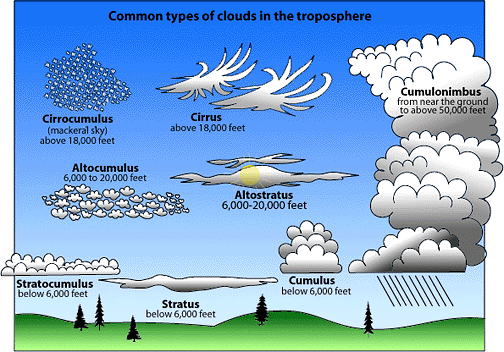
Upper levels -- CIRRO: Cirrus, Cirrostratus, Cirrocumulus
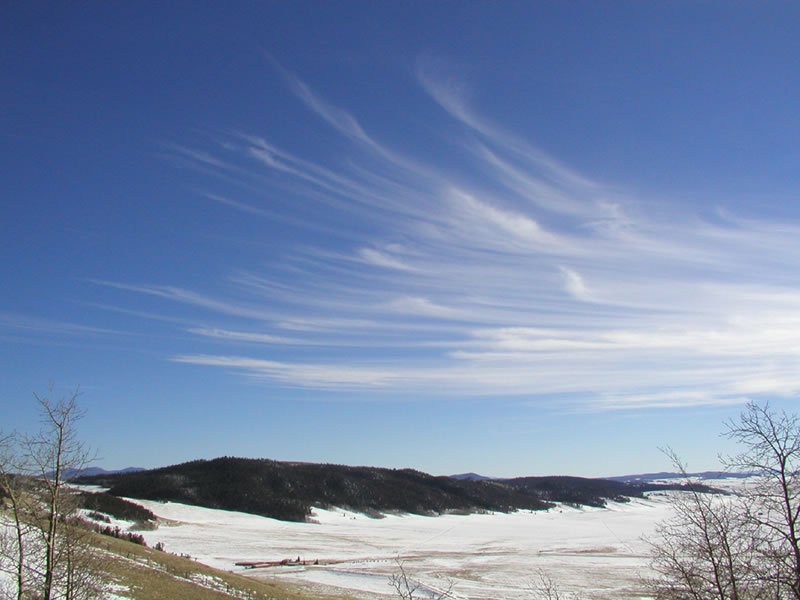
CIRRUS CLOUDS (click/tap to enlarge): Cirrus clouds are made of ice crystals and look like long, thin, wispy white streamers high in the sky. They are commonly known as "mare's tails" because they are shaped like the tail of a horse. Cirrus clouds are often seen during fair weather. But if they build up larger over time and are followed by cirrostratus clouds, there may be a warm front on the way.
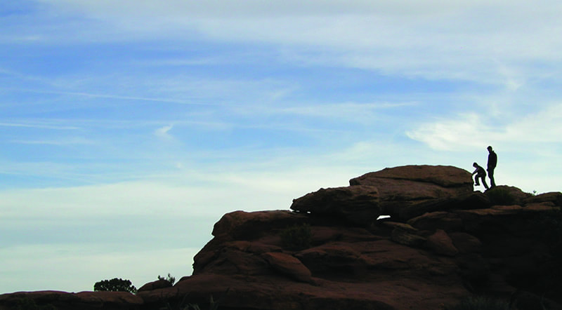
CIRROSTRATUS CLOUDS (click/tap to enlarge): Cirrostratus clouds are high, thin sheet-like thin clouds that usually cover the entire sky. The clouds are so thin that the Sun or moon can sometimes shine through and appear to have a halo as light hits the ice crystals and bends. The halo is the width of your hand held at arm's length. Cirrostratus clouds usually come 12 to 24 hours before a rain or snowstorm.
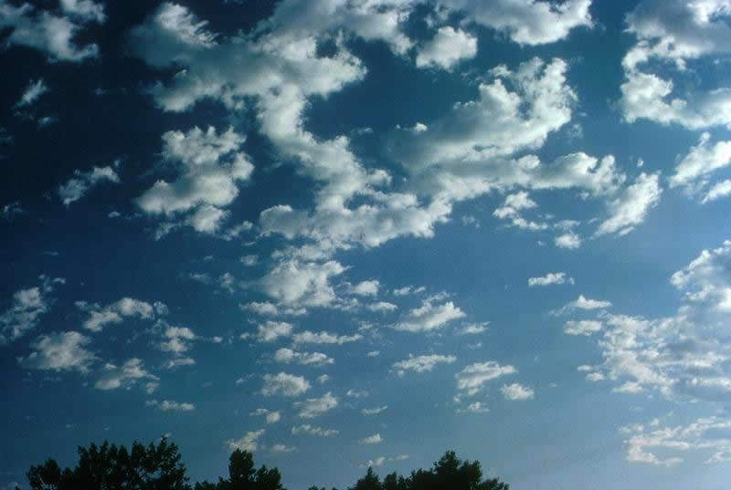
CIRROCUMULUS CLOUDS (click/tap to enlarge): Cirrocumulus clouds are small rounded puffs that usually appear in long rows high in the sky. Cirrocumulus are usually white, but sometimes appear gray. They are the same size or smaller than the width of your littlest finger when you hold up your hand at arm's length. When these clouds cover a lot of the sky, they can look like the scales of a fish, which is it is called a "mackerel sky.” Cirrocumulus are common in winter and indicate fair, but cold, weather.
Mid levels -- ALTO: Altocumulus, Altostratus
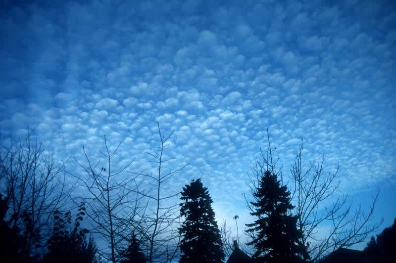
ALTOCUMULUS CLOUDS (click/tap to enlarge): Altocumulus clouds are mid-level, grayish-white with one part darker than the other. Altocumulus clouds usually form in groups and are about one kilometer thick. Altocumulus clouds are about as wide as your thumb when you hold up your hand at arm's length. If you see altocumulus clouds on a warm, humid morning, there might be a thunderstorm by late afternoon.

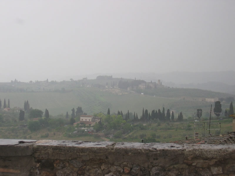
ALTOSTRATUS CLOUDS (click/tap to enlarge): Altostratus clouds are mid-level, gray or blue-gray clouds that usually covers the whole sky. The Sun or moon may shine through an altostratus cloud, but will appear watery or fuzzy. If you see altostratus clouds, a storm with continuous rain or snow might be on its way. Occasionally, rain falls from an altostratus cloud. If the rain hits the ground, then the cloud has become a nimbostratus.
Low Levels -- Stratus, Cumulus, Stratocumulus
STRATUS CLOUDS (click/tap to enlarge): Stratus clouds are low and have a uniform gray in color and can cover most or all of the sky. Stratus clouds can look like a fog that doesn't reach the ground. Light mist or drizzle is sometimes falling when stratus
clouds are in the sky.
clouds are in the sky.
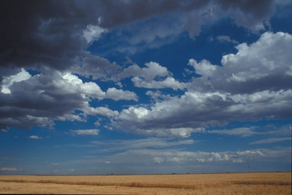
CUMULUS CLOUDS (click/tap to enlarge): Cumulus clouds have vertical growth. They are puffy white or light gray clouds that look like floating cotton balls. Cumulus clouds have sharp outlines and a flat base at a height of 1000 meters. They are generally about one kilometer wide which is about the size of your fist or larger when you hold up your hand at arm's length to look at the cloud. Cumulus clouds can be associated with fair or stormy weather. Watch for rain showers when the cloud’s tops look like cauliflower heads.

STRATOCUMULUS CLOUDS (click/tap to enlarge): Stratocumulus clouds are low, lumpy, and gray. Sometimes they line up in rows and other times they spread out. Only light rain (usually drizzle) falls from stratocumulus clouds. To distinguish between a stratocumulus and an altocumulus cloud, point your hand toward the cloud. If the cloud is about the size of your fist, then it is stratocumulus.
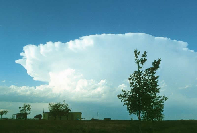
CUMULONIMBUS: THE THUNDERSTORM
UCAR
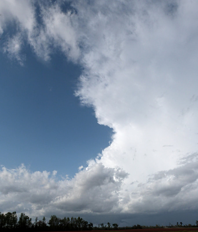
by Christopher Cawley, looking NNW toward Bladenboro, NC; 2011.
Cumulonimbus clouds have vertical growth and can grow up to 10 kilmeters high.
That is... about 6.4 miles! At this height, high winds will flatten the top of the cloud out into an anvil-like shape. Cumulonimbus clouds are thunderstorm clouds and are associated with heavy rain, snow, hail, lightning, and sometimes tornadoes.
That is... about 6.4 miles! At this height, high winds will flatten the top of the cloud out into an anvil-like shape. Cumulonimbus clouds are thunderstorm clouds and are associated with heavy rain, snow, hail, lightning, and sometimes tornadoes.